Muskrat Lake Watershed Project 2014
Introduction – Muskrat Lake Watershed Project 2014
In March 2014, the Office of Applied Research at ACOV received funding through the Water Adaptation Management and Quality Initiative (WAMQI), to work alongside community partners, such as the Muskrat Watershed Council (MWC), the Ontario Ministry of Environment and Climate Change (MOECC), and Canadian Nuclear Laboratories (CNL) to document water quality issues in the Muskrat Lake watershed in relation to current land-use practices and to gain a more thorough understanding of nutrient loading to the watershed from agricultural influences and other upstream contributors.
By gathering and analyzing data regarding water quality and quantity, and using spatial tools to classify the landscape and visualize impacts, the project aimed to both address and mitigate agricultural influences by gathering consistent, scientifically defensible data, raising public awareness, and, with the knowledge and information gathered in part through scientific research and community consultation, promote awareness and better management of nutrients. Minimizing upstream impacts of nutrients on water quality is the shared vision of the College, the Muskrat Watershed Council, and concerned citizens.
Summer 2014
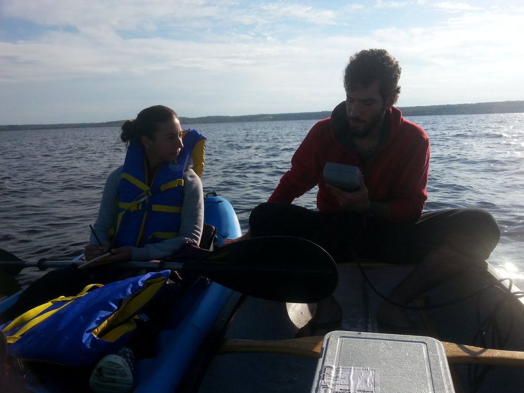
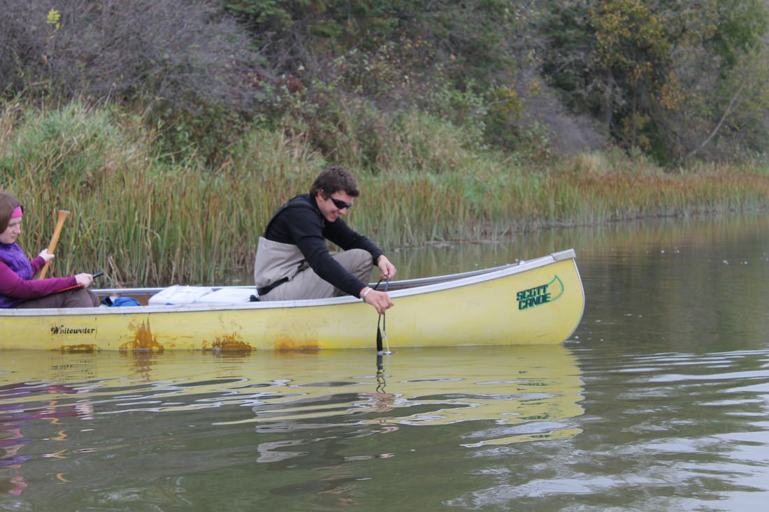
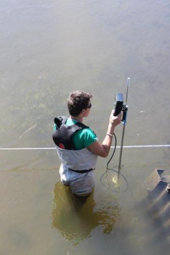
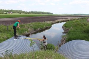 Muskrat Lake Watershed Summer Monitoring Network
Two field and lab technician co-op students from the Environmental Technician Diploma Program collected water quality and quantity data and conducted hydrology measurements at 28 sites on the Muskrat Lake watershed from May-November 2014.
The data was analyzed by the Ontario Ministry of Environment and Climate Change as well as Canadian Nuclear Laboratories. A scientific report has since been released in August 2015, known as “Water Quality (2014) in the Muskrat Lake Watershed”, written by Rebecca L. Dalton, Ph.D., Research Scientist – Biology, specializing in Chemical and Environmental Toxicology. Click here to access the report.
This monitoring network continues throughout Summer/Fall 2015.
Fall 2014
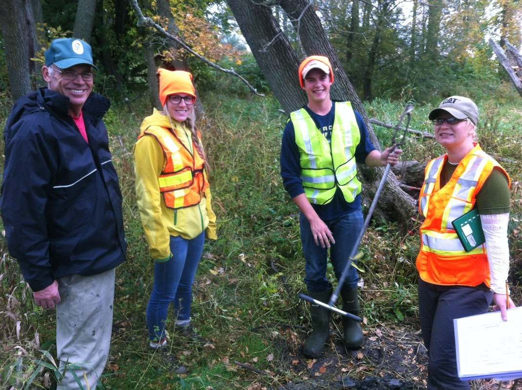
Students in the Environmental Technician program are required to partake in environmental community projects for two courses: Environmental Issues and Land & Water Stewardship. For Fall 2014, these projects focused on the Muskrat Lake watershed and interested community partner. Below is a list of our 2014 projects:
The Riparian Zone of a Local Farm
 This project is an investigative look at the riparian zone of a local farmer’s property along Muskrat Lake where flooding and changes in flow have created a cause for concern. The focus of this project is to first determine what has already occurred in this zone, to compare it to other healthier zones, and, by creating a series of indicators, to deduce what represents a “normal” or healthy riparian zone.
Sediment Project on Muskrat Lake
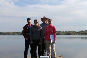 The overall theme of this project is to determine what lies at the bottom of Muskrat Lake. The low-laying sediment at the bottom of Muskrat Lake could yield some clues as to whether the lake is improving or degrading. Muskrat Lake is known as a very productive lake with respect to fishing and recreation. Local, provincial, and federal authorities have, and continue to be, concerned with the state of the lake. Nutrient loading, primarily phosphorous and nitrogen, from its many tributaries has compromised the integrity of the lake. The purpose of this project is to collect lake bottom sediment to determine current phosphorous levels, how much nutrient loading has occurred over time, and whether the lake is naturally eutrophic.
Bioswale for Shaw Woods Outdoor Education Centre
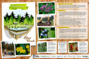 The aim of the Shaw Woods Outdoor Education Centre (SWOEC) Bioswale Project is to construct a Bioswale to filter runoff from the SWOEC parking lot. It is often the case that the natural flow of water and nutrients is disrupted by anthropocentric activities. This can cause critical changes in the surrounding area and without some kind of mitigation can be catastrophic to an ecosystem. The Bioswale, which includes three underground pipes that divert runoff downhill toward a Bioswale (series of native plant species ideal for filtering potentially harmful material), stone, wood chips, and other base layer materials, is an effort to protect the surrounding ecosystem, including the Snake River, which is adjacent to the SWOEC, from further anthropogenic disturbances.
Biederman Creek Wash-out on Lake Dore
 This project concerns the health of a waterfront property on the Snake River at Lake Dore. Recently, roads were washed out when a local beaver dam fell apart. The washout caused asphalt and other road materials to flow into the creek. There is concern regarding the impacts these potentially harmful materials may have on the ecosystem specific to that shoreline. The purpose of this project will be to perform qualitative and quantitative assessments of the accident site and identify whether the ecosystem is at risk.
Determining Nutrient “Hot Spots” on the Snake River
 Farming has been a staple to the local economy for well over 100 years along the banks of the Snake River. Farming, of course, includes fertilization, the introduction of large herds of livestock and cash crops. These factors can contribute to nutrient loading in nearby watersheds. Within Renfrew County, many of the ditches created to mitigate runoff issues along the Snake River are not up to par nor have farming practices been updated in some areas. This has created a situation where nutrient release is much higher than normal, creating a significant amount of loading in the waterway. The purpose of this project is to determine exactly how much loading is occurring along the Snake River, where the sources of loading exist, and finally recommendations on how to mitigate “hot spots”.
Muskrat Water Quality Data – Interpreting Data Collection
 For this project, students are tasked with summarizing the raw data collected from summer sampling into interpretive formats, such as charts and GIS, with a focus on Phosphorus, alkalinity, pH, and total suspended solids. The goal is to share the interpretive data with the Muskrat Watershed Council’s Science Committee in order that the Committee analyze the data, compare it with analysis conducted by the Ministry of Environment, and develop recommendations/solutions.