Light Aircraft Remote Sensing
Small Scale Environmental Applications (NSERC Engage Grants)
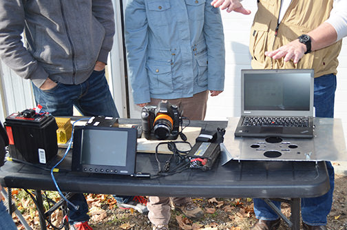 Remote sensing technologies such as LiDAR, Multispectral imagery, and Infrared technologies have long been employed and continue to be applied for forest stand characterization, biomass estimation, broad scale bloom detection, land use assessment, agricultural inventories, topography mapping, and wetland characterization. These products have historically been high-priced and applied to large scale, heavily funded projects, and consequently underutilized by small businesses working in the environmental and forestry sectors. Waterfront Campus professors and students are working with the Ontario Resource Management Group, Inc. to apply these same tools for environmental monitoring and local environmental issues assessment and resolution, specifically in the areas of:
- Quantification and mapping of cyanobacterial algal blooms which are a human health threat
- Quantification of aggregate volume removals from aggregate pits (e.g., gravel) using 3D modelling of locally acquired imagery